Selected projects
|
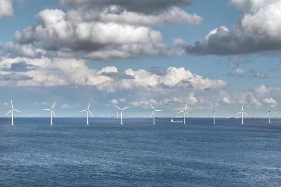
Including fisheries in plans for offshore energy development
There is a big push to move to greener sources of energy. Offshore wind farms are promising sources of cleaner energy, and they are being established all over the world. With this project we will ensure fishing activities in the Gulf of Mexico will be less disrupted by this new use of the ocean. Status: Ongoing Partners: NOAA (USA), myAcorn Limited (UK) |
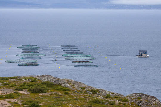
Planning for aquaculture in the Gulf of Mexico
With many marine fish stocks already overfished, but demand for food rising, a large proportion of our seafood now comes from aquaculture. But by putting sites aside for aquaculture development we are taking area that was used for other activities such as wild fishing or navigation. This project looks at modeling the socioeconomic impacts of setting aquaculture sites in the Gulf of Mexico.
Status: Ongoing
Project partners: NOAA, University of Florida (USA)
Ecosystem-based fisheries management plan
I’m helping building an ecosystem-based fisheries management plan for the US Caribbean. Ecosystem-based management is a holistic approach that aims at managing all: land, waters, the living resources in them, and us, humans, in an integrated way, to promote conservation and sustainable resource use. We’re working on the first step of this plan which allows to understand the drivers of this complex socio-ecological system. I'm helping making a roadmap to identify key variables driving the system and gathering data that could help us understanding it.
Status: Ongoing
Project partners: University of Puerto Rico, Institute for Socio-Ecological Research (Puerto Rico) and University of New Haven (USA)
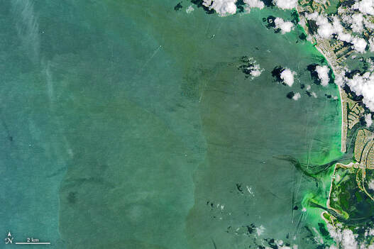
Red tides impacts in fisheries
Red tides are blooms of tiny algae that can kill marine organisms and affect human health. With this project, we want to assess the effects that red tides have had in fishing activity along the west Florida coast.
Status: Ongoing
Project partners: NOAA (USA)
Red tides are blooms of tiny algae that can kill marine organisms and affect human health. With this project, we want to assess the effects that red tides have had in fishing activity along the west Florida coast.
Status: Ongoing
Project partners: NOAA (USA)
|
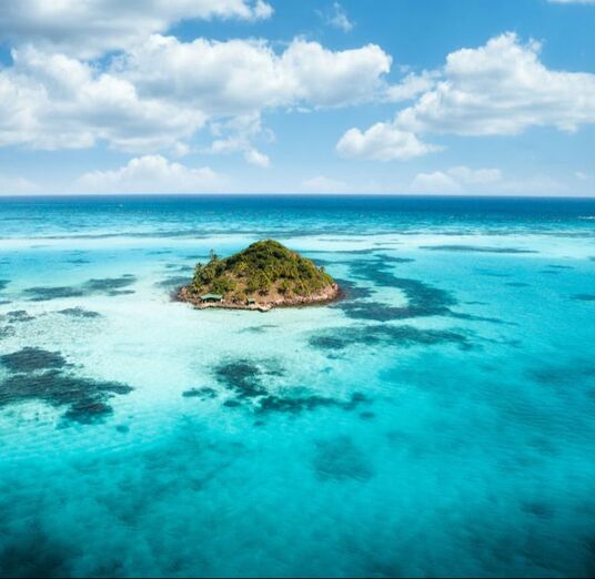
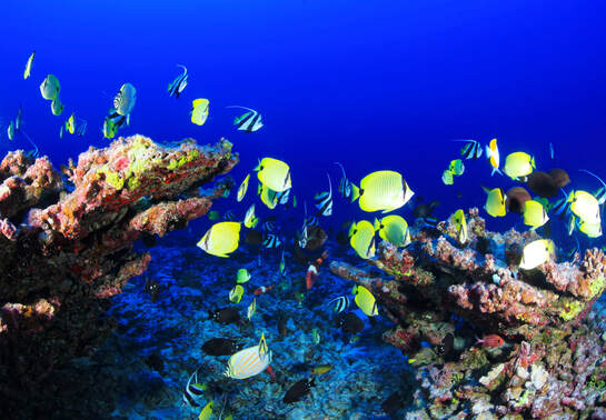
Prioritizing reefs in the Caribbean
We all dream with a Caribbean reef island. Turquoise water. Warm sand, beautiful sealife. But human activities and climate change are threatening reefs and the livelihoods of people that depend on them. With this project I am using climate change predictions, remote sensing and modeled data to identify Caribbean reefs that are more likely to withstand imminent climate impacts. These reefs will be priority for management actions directed to protect, restore and sustainably use these sites. You can read about this work in Global Change Biology It was covered by the BBC and Cool Green Science! Status: Finished Project partners: TNC (Dominican Republic and USA) |
|
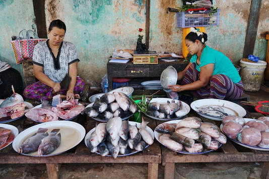
Valuing marine fishery systems
We are valuing marine fishery systems by considering both, the value of the catch, and how much fish inside the water is worth. Using population models, we can also look ahead and value marine ecosystems in the future after different management actions are taken (for example, after reducing fishing effort or implementing marine reserves). This comprehensive piece uses detailed in situ data of fish catches and underwater surveys of fish biomass, as well as modeled data. Status: Finished Project partners: Rare (USA) |
|
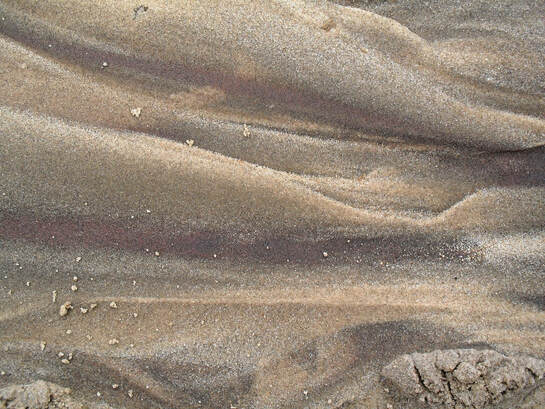
Mapping sediments
I'm mapping sediment fractions in the Gulf of Mexico and the US South Atlantic. From a bunch of samples, I am producing maps for the region using geostatistical analyses and spatial interpolation. For this project I am using compositional kriging, which is great at handling this type of data. This is a challenging, big data task! The maps will help efforts in this intensively studied region, such as mapping habitat suitability, species distributions, or identifying fishing grounds. Status: Finished Project partner: NOAA (USA) |

|
Reserve design to benefit both fish and people
We want people to fish forever. Combining GIS, spatial analyses, marine spatial planning and spatially explicit population models we are choosing reserve locations (sites closed to fishing) that will maximize benefits to fishers. When reserves are placed appropriately, marine resources thrive and can "spillover" to nearby areas contributing to local fisheries by replenishing marine resources. So far we have worked in the Mesoamerican reef , the Philippines and Indonesia with this ambitious, long-term project. Status: Finished Project partners: Rare, Louisiana State University (USA), Deakin University (Australia) and University of Leeds (UK). |
|
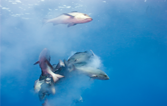
Depleted fish spawning aggregations
Fish spawning aggregations are a spectacular sight. For many species these events occur at the same spot year after year, and are critical areas for protection. But because of overfishing, many spawning aggregation sites are now depleted and aggregations no longer form there. Should we then include them or skip them in management plans? This project aims to answer this challenging and important question. Find the answer here! (Photo by Mark Priest) Status: Finished Project partners: LGL Ecological Research (USA), Comunidad y Biodiversidad A. C. (Mexico), University of Queensland (Australia) |
|
Fish marine biogeography
For this project we looked at biogeographical patterns of reef fish in the wider Caribbean using information from different databases. Will we get the same answer if we ask the same question to different databases? The short answer is: No! If you want to know more about it click here Status: Finished Project partners: Smithsonian Tropical Research Institute (Panama) |
|
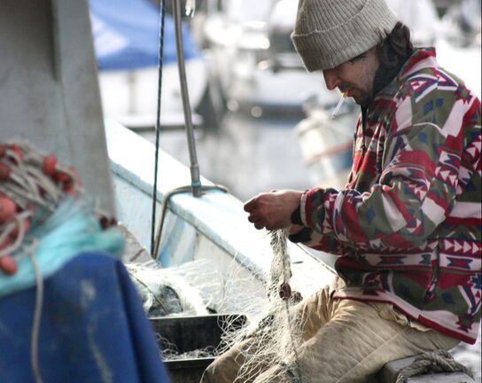
Fishers personalities from vessel movement data
I have worked tracking the position of fishing vessels large and small, from pelagic trawlers to canoes gathering mangrove crabs. With this last project we used positional information to gain insight into the behavior of fishers and their personality: do they like taking risks or they don't? Do they explore for new grounds or go to the same fishing spot over and over again? Different people respond differently to changes such as disturbances, new policies or management actions. We hope our framework to identify fisher types will help improve management outcomes. Do you want to read more? Click here Status: Finished Project partners: University of California Davis, National Oceanic and Atmospheric Administration (USA) |
